Category: Maps
-
Map: Circle of Cyanos

Home of the Cult Order of Cyanos. The Circle of Cyanos is the headquarters for the newly risen Order of Cyanos. Not much is known about Cyanos or this order. Average citizens are flocking to the Circle, believing that all their suffering will be alleviated by Cyanos and some secret ritual there. Will our heroes…
-
Map: Low Mountain City
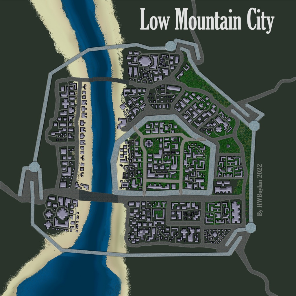
A walled city straddling a river, Low Mountain City is nestled at the foot of the looming Brokenfangs Mountain Range and is about half a days ride from the southern coast. Inner Wall The inner wall protects the nobles and other influential members. The inner wall is double the thickness of the outer wall, but…
-
Map: Atrium

Soaring walls of windows. Large 3-step entrances with pillars at either end. Four rooms on either side have glass windows up to a partially domed glass ceilings.
-
Map: Allegreyo – City on the Bay

A fantasy cartography map of a crowded city, originally pencil sketched and then modified in Photoshop.
-
Map: Rosario Manor House

A fantasy house floorplan with a main level and a hidden dungeon and tunnels below.
-
Map: The Great Spire

I envision this massive tower structure with landings every 35-50 steps. A large, wide archway leads immediately to imposing steep stairs going up. To the left of the entry arch are 3 smaller arches that lead into the stables. A door on the right at the base of the stairs leads to the only room…
-
Map: Castle Darkhope

Discovered in the lost ruins of Gauntlet Green is a map of Castle Darkhope, where the throne of Delzoun once ruled.
-
Map: Cave City Sketch

Sketched map of a city inside of a cave with a path winding up to the royal abode.
-
Map: Pillar House Tavern & Inn

Pillar House History The Pillar House straddles a canyon where a tributary of the Irewrathe River rushes past 50 feet below. This is the narrowest spot to cross the wild Irewrathe River for many miles. This tributary was always popular with those wanting to avoid the main routes guarded by local constabulary. The owner, Galspar…
-
Map: Academy of the Anchor Accords

Here is the map of fictional Academy of the Anchor Accords, originally drawn in pencil and overlayed in Photoshop with some lovely straight lines and doors. Classrooms on the left and student dorms on the right. Admin and janitorial in the center. Secret doors can be found throughout the Academy from staff wanting to avoid…